
Best Hiking on the Blue Ridge Parkway (North Carolina)
Cates Compass contains affiliate links and is a member of the Amazon Services LLC Associates Program. If you make a purchase using one of these Amazon links, I may receive compensation at no extra cost to you. Read my disclaimer for more information.
If you’re searching for the best hiking on the Blue Ridge Parkway, you’re in the right place.
The Parkway runs through some of the most beautiful mountains in the eastern United States, and many of the best hikes in North Carolina are located just minutes off the road. It also happens to be one of my favorite places ON EARTH, and I’ve spent countless hours driving it.
Many of my favorites are right off the Blue Ridge Parkway, and after hiking in North Carolina for nearly five years, I’ve done most of the trails worth your time.
One of the best things about hiking here is how accessible it is. You can spend the day driving a section of one of the most scenic roads in America while stopping for hikes that lead to waterfalls, panoramic overlooks, and high-elevation summits. I mean truly, what more could you want?
In this guide, I’m sharing my favorite Blue Ridge Parkway hiking trails, including the best hikes near Asheville and Boone, as well as several short hikes with huge payoffs. Many of these trails are located near some of the best mountain towns in North Carolina, making them perfect additions to a weekend trip.
Quick Guide
Best Views: Waterrock Knob
Best Waterfall: Linville Falls
Best Short Hike: Devils Courthouse
Best Sunset: Black Balsam Knob
Best Sunrise: Rough Ridge
Map of Blue Ridge Parkway Hikes
The Blue Ridge Parkway stretches for 469 miles, connecting Shenandoah National Park in Virginia to Great Smoky Mountains National Park in North Carolina. Because of this, the hikes along the Parkway are spread out across multiple regions.
Many of the trails on this list are clustered around a few key areas:
- Boone / Linville area – Rough Ridge, Beacon Heights, Price Lake, and Linville Falls
- Craggy Gardens area near Asheville – Craggy Pinnacle and Lane Pinnacle
- Pisgah area south of Asheville – Black Balsam Knob, Graveyard Fields, Frying Pan Tower, and Devil’s Courthouse
- Western Parkway near Cherokee – Waterrock Knob
This list does not cover hikes in Virginia, as I haven’t spent dedicated time there (it’s beautiful and I need to go, I know).
Adding these hikes to a Blue Ridge Parkway road trip makes it easy to experience some of the best hiking trails in North Carolina in a single day or weekend.
Best Time to Hike the Blue Ridge Parkway
The best time to hike the Blue Ridge Parkway depends on what type of scenery you’re hoping to experience. I love the Parkway in all seasons, but each one offers something unique.
Spring (April–May)
Wildflowers begin blooming, and waterfalls are often at their strongest after spring rains. This is an amazing time to enjoy more popular trails as they tend to be at their peak from mid-summer to the end of fall.
Early Summer (June)
This is one of the most beautiful times to hike near Craggy Gardens, when rhododendrons bloom along the mountains. Late May to early June is ideal for wildflower sightings, especially in the higher elevations. Some popular flowers I have tattoos of include fire azaleas, dogwoods, rhododendrons, and mountain laurels.
Summer (July–August)
Long daylight hours make it ideal for sunrise and sunset hikes, though some trails can be busy. Photography during this time is amazing since afternoon storms can create the most beautiful sunsets, and the greenery tends to be out of this world.
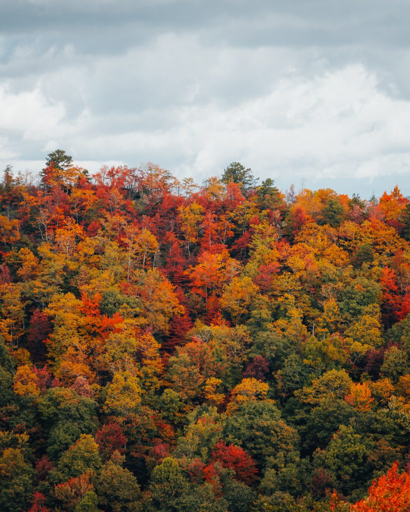
Fall (Late September–October)
The fall foliage season is one of the most popular times to visit the Blue Ridge Parkway, especially near Rough Ridge and Beacon Heights. As someone who is obsessed with fall, I can confidently say that it’s worth the headache of dealing with tons of cars on the parkway.
If you visit during this time and it’s not a day trip, book your accommodation early and hike early in the morning or late in the evening (especially on the parkway).
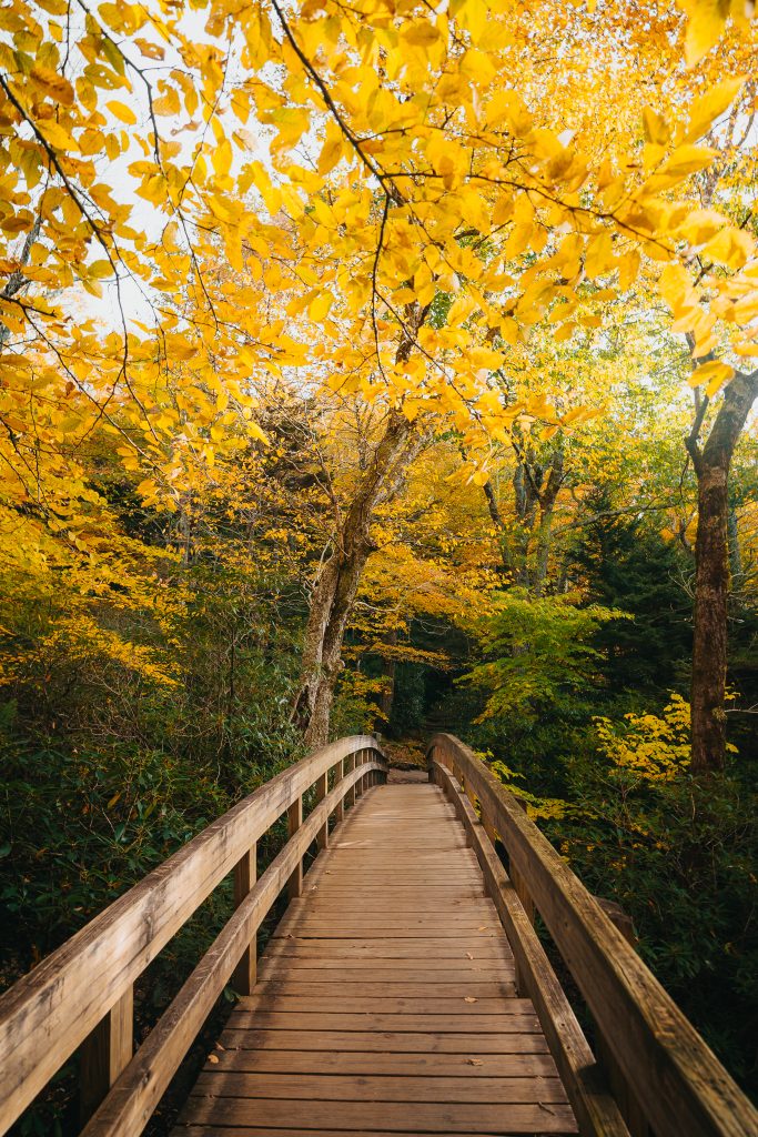
Price Lake Loop Trail
Distance: 2.3 miles
Difficulty: Easy
Location: Milepost 296.7
Parking Details: Easy to park
If you’re looking for an easy hike on the Blue Ridge Parkway, the Price Lake Loop Trail is a fantastic option. This scenic loop circles the shoreline of Price Lake and offers beautiful views of the surrounding mountains and forest.
The trail is relatively flat, making it a great choice for families, beginner hikers, or anyone wanting a relaxing walk in nature. You’ll follow a well-maintained path through rhododendron tunnels and peaceful wooded sections before emerging at several scenic viewpoints along the lake.
One of the highlights of this hike is how calm and quiet the area feels, especially in the early morning. The reflections of the mountains on the lake can be stunning when the water is still.
Photography here in the fall is exceptional, especially if there’s a lake effect from cooler mornings with fog on the water.
Best time to visit:
Fall is particularly beautiful here when the surrounding trees change colors, but the trail is enjoyable year-round.
Rough Ridge Trail
Distance: 1.5 miles round trip
Difficulty: Moderate
Location: Milepost 302.8
Parking Details: Decent-sized paved lot right off the parkway (Tanwana Trailhead), but parking fills up quickly on weekends or during peak fall foliage.
Rough Ridge Trail is one of the most iconic hikes on the Blue Ridge Parkway, and for good reason. The sweeping views from the rocky outcrops along this trail are some of the best in North Carolina.
The hike begins with a series of boardwalk stairs, then transitions to a rocky path that gradually climbs along the ridge. While the hike itself is fairly short, the elevation gain will definitely get your heart rate up.
I’ve taken some of my favorite photos in North Carolina on this trail, especially during the fall when the mountains explode with color. The best viewpoint is actually just past the boardwalk, about 0.3–0.4 miles, where you’ll get a stunning overlook of the surrounding Blue Ridge Mountains.
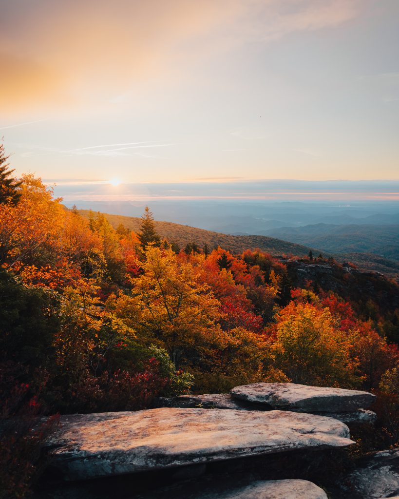
This trail is incredibly popular, particularly during peak fall foliage season. If you want to avoid the crowds, I highly recommend hiking here for sunrise instead of sunset.
The parking lot has a decent number of spaces, but it fills up quickly. Thankfully, the hike is short, so turnover can happen fairly fast, but you may still need to wait for a spot during busy weekends.
I’ve hiked this trail more times than I can count, and it never disappoints.
Best time to visit:
Early October, during peak fall foliage, or sunrise year-round, for fewer crowds.
Beacon Heights Trail
Distance: 1 mile round trip
Difficulty: Easy
Location: Milepost 305.2
Parking Details: Small paved lot off the parkway
If you’re looking for a short hike on the Blue Ridge Parkway with a big payoff, the Beacon Heights Trail is an excellent choice.
The hike is short and relatively easy, making it a great option if you want incredible mountain views without committing to a long trail. After a gradual climb through the forest, the trail opens onto a series of rocky outcrops offering beautiful panoramic views of the surrounding Blue Ridge Mountains.
While the views aren’t quite as dramatic as nearby Rough Ridge, Beacon Heights tends to be less crowded, which makes it a fantastic alternative. It’s also less challenging and has more space to sit and enjoy the view.
There are several flat rock areas near the summit that are perfect for laying out a blanket or enjoying a picnic while enjoying a sunrise or sunset
Best time to visit:
Sunrise or sunset for the best lighting and cooler temperatures.
Flat Rock Trail
Distance: 2 miles round trip
Difficulty: Easy
Location: Milepost 308.3
Parking Details: Lots of parking off the Parkway with space for everyone
The Flat Rock Trail is a quieter hike along the Blue Ridge Parkway, offering a beautiful overlook of the town of Linville. If you want a trail in this area that feels a little less trafficked than some of the more famous Parkway hikes, this is a solid option.
The trail climbs steadily through the forest before reaching the rocky overlook. Once you reach the top, you’ll get wide-open views that make the effort worth it.
Because it doesn’t get the same attention as places like Rough Ridge or Beacon Heights, Flat Rock can be a nice pick if you’re hoping for a more peaceful hike. It’s a good option when you still want a scenic payoff without dealing with as many people.
Best time to visit:
Fall is especially beautiful when the surrounding mountains start to change color, but this trail is lovely throughout the year.
Linville Falls Trail
Distance: Varies (1.6–2 miles depending on viewpoints)
Difficulty: Easy to Moderate
Location: Milepost 316.4
Parking Details: Abundant since it’s so busy, but it is still likely to fill up on busy weekends like peak fall or holidays
The Linville Falls Trail is one of the most famous waterfall hikes on the Blue Ridge Parkway, and it’s easy to see why. This trail leads to multiple viewpoints overlooking the powerful Linville Falls as it drops into the Linville Gorge.
This is one of the first hikes I ever did in Western North Carolina after camping at Linville Falls Campground.
From the visitor center, the trail splits into several routes that lead to different overlooks. The Erwins View Trail is the most popular option and provides several scenic viewpoints along the way. Each overlook offers a slightly different perspective on the waterfall and the rugged gorge below.
One of the most popular viewpoints is Erwin’s View, where you can see the upper and lower sections of the waterfall cascading through the gorge. The trail is well-maintained and relatively short, making it a great option for a quick stop while driving the Parkway.
Because Linville Falls is such a well-known destination, it can get very busy, especially during weekends in the summer and fall. If possible, try to visit early in the morning to avoid the crowds.
If you enjoy waterfall hikes, North Carolina is full of them, and you can explore some of the best waterfalls in North Carolina across the region.
Best time to visit:
Spring and early summer, when water levels are highest, or fall for beautiful foliage surrounding the gorge.
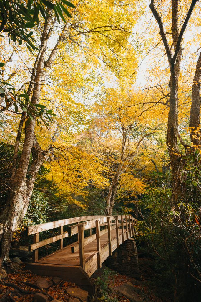
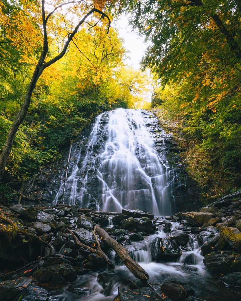
Crabtree Falls Loop Trail
Distance: Varies 2.5-mile loop
Difficulty: Moderate
Location: Milepost 339.5
Parking Details: Large parking lot right off the parkway
The Crabtree Falls Loop Trail is one of the best waterfall hikes on the Blue Ridge Parkway, leading to a beautiful 60-foot cascade tucked into a lush forest.
This trail sustained significant damage during Hurricane Helene and may pose additional challenges as a result. Despite this, the waterfall is one of my favorites, and I’m hoping to revisit it at some point in 2026.
The trail descends gradually through woods filled with rhododendrons and mossy rocks before reaching the base of Crabtree Falls. The base of the waterfall is an amazing spot for photos, and the area downstream is a nice place to take a quick dip if you need to cool off.
After the falls, the trail continues along the loop and climbs steadily back to the parking area. Because of this uphill return, the hike can feel a bit more challenging on the way out, but the distance is still manageable for most hikers. If you don’t want to do the loop, you can also just do an out-and-back.
Compared to Linville Falls, Crabtree Falls tends to feel a bit more secluded, making it a great option if you want a waterfall hike without quite as many crowds.
Best time to visit:
Spring and early summer are ideal when water levels are strongest, and the surrounding forest is especially vibrant and filled with wildflowers.
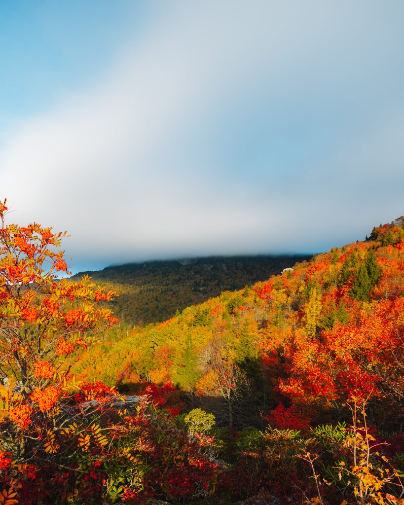
Deep Gap Trail to Mt. Craig (Mt. Mitchell)
Distance: ~3 miles round trip
Difficulty: Moderate
Location: Mount Mitchell State Park (near Milepost 355)
Parking Details: Mount Mitchell State Park has a lot of parking!
If you want to experience some of the highest elevations in the eastern United States, the hike from Deep Gap to Mount Craig is an excellent choice.
Mount Mitchell is the highest peak east of the Mississippi River, and while many visitors simply drive to the summit, hiking in this area offers a much more rewarding experience.
The trail from Deep Gap climbs steadily along the ridgeline to Mount Craig, the second-highest peak in the Black Mountains. You can make this hike even longer and continue to the backcountry site if you want a little more time on the trail.
Along the way, you’ll pass through dense spruce-fir forest that feels completely different from the lower elevations along the Parkway. The cooler temperatures and alpine-like environment make this hike feel almost like you’ve stepped into a different region.
Once you reach the rocky summit of Mount Craig, you’ll be rewarded with expansive mountain views that stretch across the surrounding peaks. There’s nothing quite like the layers of the Blue Ridge Mountains, and this is a great place to experience just that.
Because this hike starts at such a high elevation, the weather here can change quickly, and temperatures are often cooler than in nearby towns. Make sure to bring an extra layer and check the forecast before heading out.
Best time to visit:
Late spring through fall, when the trails are clear, and the high-elevation views are at their best.
Craggy Pinnacle Trail
Distance: 1.4 miles round trip
Difficulty: Moderate
Location: Milepost 364.1
Parking Details: Large lot with plenty of spaces
The Craggy Pinnacle Trail is one of the most popular hikes on the Blue Ridge Parkway, and for good reason. The trail leads to a rocky summit with sweeping views of the surrounding Blue Ridge Mountains.
The hike begins with a gradual climb through a forest filled with twisted trees and dense rhododendron tunnels. After about 0.7 miles, the trail reaches a rocky overlook where you’ll get incredible panoramic views.
Connor and I hiked this trail in late November 2019, and it was actually the very first trail I ever did in Western North Carolina. We were visiting Asheville while looking at Charlotte as a place to live. Although things turned out very differently (and I’m happy they did!), it opened up my eyes to the world of hiking on the Blue Ridge.
One of the best times to hike Craggy Pinnacle is in June when the rhododendrons bloom. The pink and purple flowers completely transform the landscape, making this one of the most beautiful spots along the Parkway.
This trail is exceptionally popular, but the parking lot is fairly large, which usually makes it easier to find a spot compared to some of the smaller trailheads along the Parkway.
One thing to be prepared for here is the wind. Because the summit is so exposed, it can get incredibly windy at the top. If you have long hair, you’ll probably want to pull it back unless you enjoy hiking with it blowing directly in your face.
Because of the wind and the high elevation, you’ll want to pack layers, as it can be WAY cooler and more unpredictable than down in Asheville. Like seriously, it can drop almost 30 degrees on your way up.
Best time to visit:
June, during rhododendron bloom, or early morning to avoid crowds.
Lane Pinnacle Trail
Distance: 4.2 miles round trip
Difficulty: Moderate
Location: Milepost 364.4
Parking Details: Either park at Snowball Trailhead or in the small dirt pull-off where the Alltrails map intersects the parkway
If you’re looking for a hike near Craggy Gardens that sees far fewer people, the Lane Pinnacle Trail is a fantastic alternative.
This trail follows a portion of the Mountains-to-Sea Trail (MST) and leads to a rocky overlook with stunning views looking south toward Black Mountain and Old Fort. The hike climbs steadily through the forest before reaching the exposed viewpoint at the summit.
While this hike is very close to the popular Craggy Pinnacle Trail, it receives a fraction of the traffic, making it a great option for a quieter experience along the Blue Ridge Parkway.
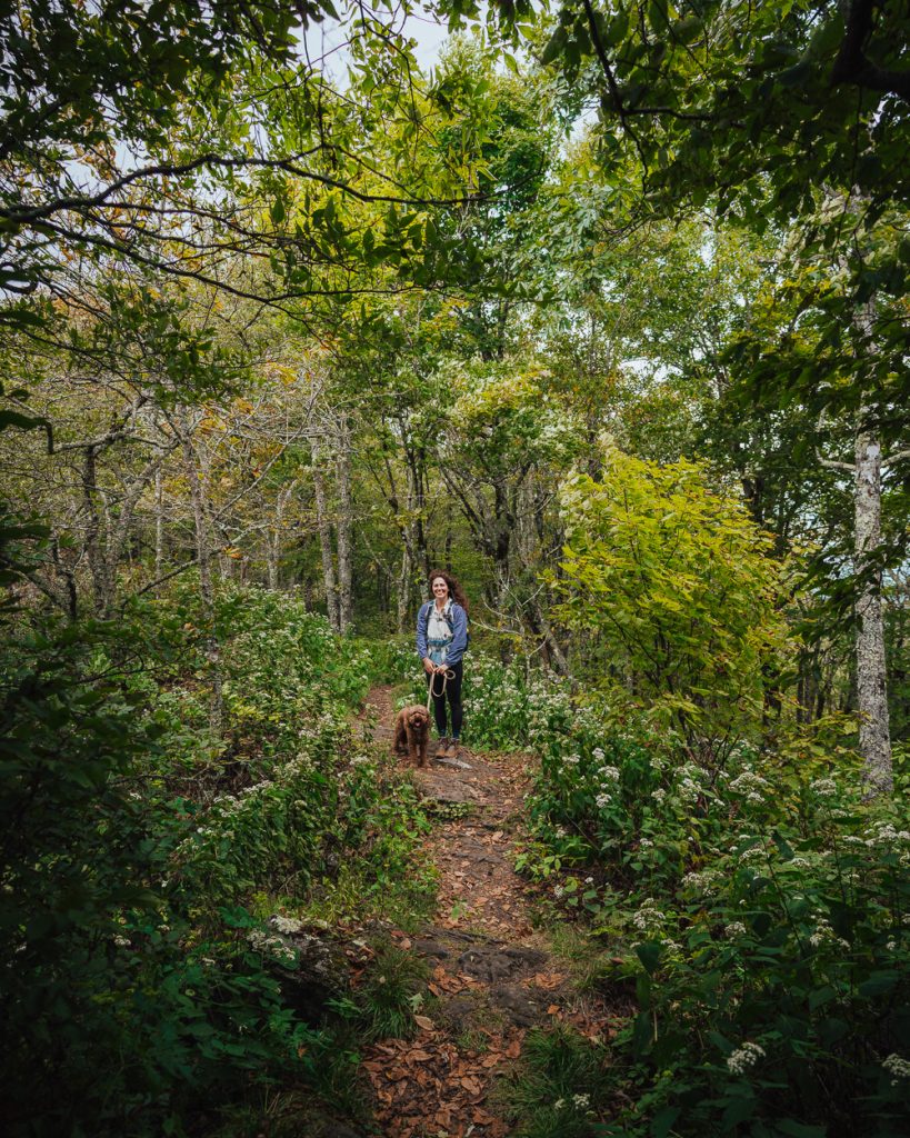
One thing to be aware of at the summit is that there are some steep drop-offs near the overlook. If you’re hiking with dogs, it’s a good idea to keep them close or hold onto them while enjoying the views.
I haven’t personally been back on this trail since Hurricane Helene, so trail conditions may vary depending on how much maintenance has been done in the area.
If you’d prefer to shorten the hike, there’s a small dirt pull-off along the road where the AllTrails map intersects the parkway. It makes the hike more like 2.5 miles round trip.
Best time to visit:
Fall offers incredible views of the surrounding mountains, but the trail is beautiful year-round.
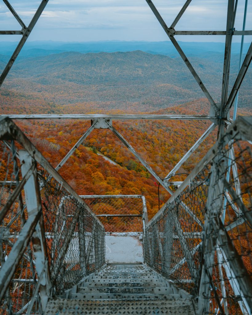
Frying Pan Mountain Lookout Tower
Distance: 1.5 miles round trip
Difficulty: Moderate
Location: Milepost 409.6
Parking Details: Dirt pull-off that can accommodate around 10 vehicles (PLEASE do not park people in or park on the Blue Ridge Parkway)
The Frying Pan Mountain Lookout Tower is one of the most unique hikes on the Blue Ridge Parkway, thanks to the historic fire tower located at the summit.
The hike follows what appears to be an old service road, gradually climbing through the forest until you reach the tall metal fire tower at the top. While the hike itself isn’t very long, the steady uphill climb can be challenging for some.
At the summit, you’ll find the Frying Pan Lookout Tower, which offers incredible 360-degree views of the surrounding mountains. The tower itself can feel a little rickety and sketchy, but even climbing partway up the stairs provides fantastic views and photo opportunities.
Parking here is limited to a gravel pull-off at the trailhead, which can usually fit around 10 cars. Because this hike is located relatively close to Asheville, it can become quite busy, especially during the fall foliage season.
I’ve attempted sunrise here multiple times but ended up completely socked in with clouds each time. In my experience, this spot tends to produce better lighting for sunset instead.
If you’re hoping to visit during golden hour, I recommend going on a weekday or arriving early to secure parking.
The tower is sometimes closed at the top, but you can still get great views. I have brought my dog on this hike with no issues, but the tower can be intimidating for many dogs because the stairs are metal.
This area is also close to several great hikes near Hendersonville, making it easy to combine them in one day.
Best time to visit:
Sunset for the best lighting, especially during the fall foliage season.
Graveyard Fields Loop Trail
Distance: 1.5 miles round trip
Difficulty: Moderate
Location: Milepost 418.8
Parking Details: Paved lot that fills up quickly, especially on popular weekends
The Graveyard Fields Loop Trail is one of the most visited Blue Ridge Parkway hiking trails thanks to its waterfalls, wide-open mountain views, and seasonal wildflowers.
The hike begins with a short descent from the parking area, then reaches the first waterfall, Lower Falls, about 0.3 miles from the trailhead. This section of the trail is very popular because it’s a relatively short walk to a beautiful waterfall.
If you continue along the loop, you’ll hike through open meadows and rolling mountain terrain before reaching Upper Falls, another scenic waterfall that requires a short spur trail to access.
Graveyard Fields is especially well known for its wild blueberries in late summer, which attract both hikers and wildlife. In the fall, the valley fills with vibrant colors, making it one of the most beautiful spots along the Parkway.
Because of its accessibility and scenery, this area can get very crowded, particularly on fall weekends. The parking lot is small for the number of visitors, and thus can be rather chaotic during the busiest times.
This area is also near several other trails, including some of my favorite hikes near Brevard, which is another great outdoor hub in Western North Carolina.
Best time to visit:
Late summer for blueberry season or early fall for colorful foliage.
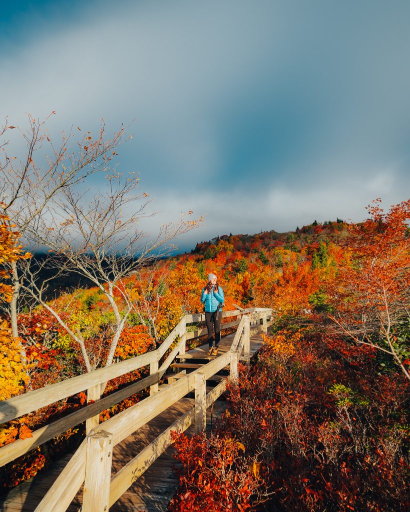
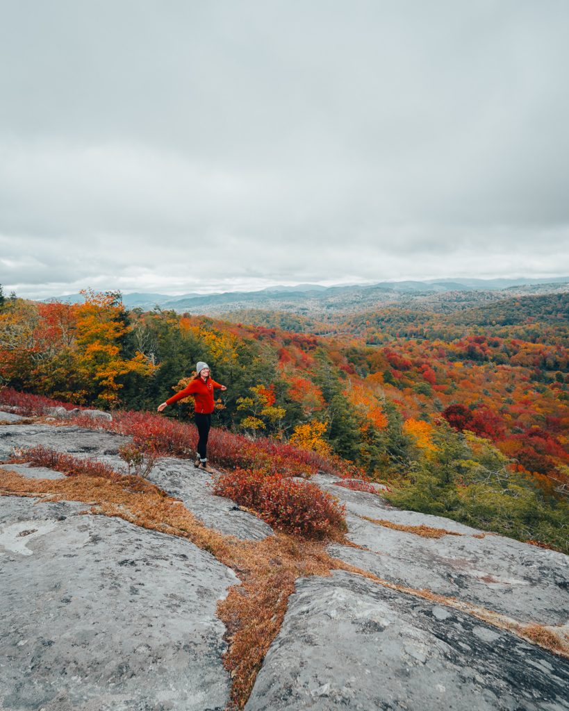
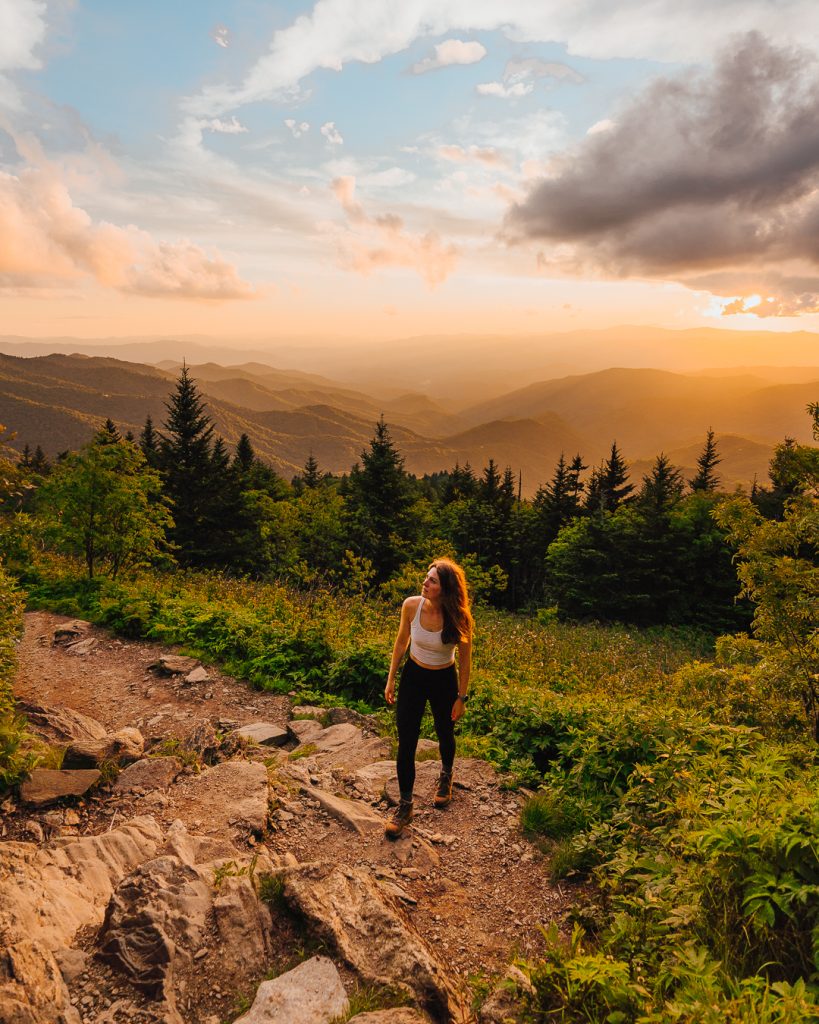
Black Balsam Knob Trail
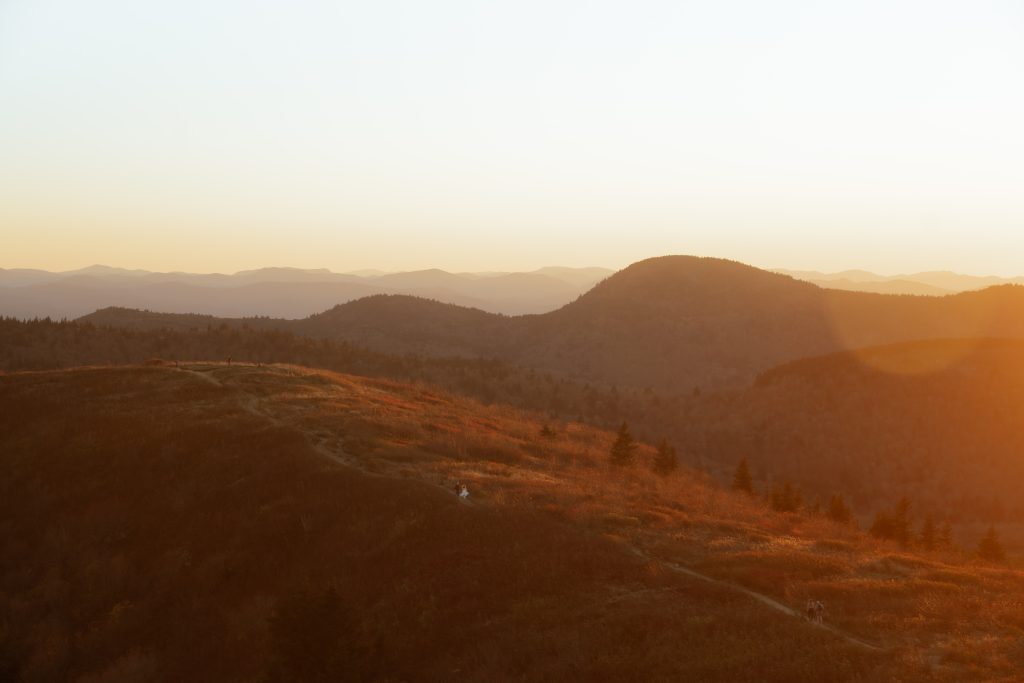
Image By: FindYara Photography
Distance: 1.5–5+ miles depending on route
Difficulty: Moderate
Location: Milepost 420.2
Parking Details: Only shoulder road parking that can get crazy during peak fall foliage.
The Black Balsam Knob Trail is easily one of the most beautiful places to hike along the Blue Ridge Parkway. I cannot begin to describe my love for this hike/area, and many of my friends also consider it one of their favorites.
This area offers sweeping 360-degree views of the surrounding mountains and wide-open grassy balds, making it feel completely different from the forested trails nearby.
One of the best things about hiking here is that it’s truly a choose-your-own-adventure experience. You can do a shorter out-and-back hike of about 1.5–2 miles to the summit, or extend your adventure by connecting to other trails in the area, including portions of the Art Loeb Trail.
My women’s retreat, River and Root, visited this location as a group hike in the fall, and it was a highlight for many of the women. The parking was beyond stressful as we didn’t arrive until close to 10 a.m., so if you get anxious in situations like this, I encourage you to arrive much earlier or visit in the off-season.
The summit of Black Balsam Knob is completely exposed, which means you’ll get incredible views in every direction. Because there’s very little tree coverage, it’s also important to bring sunscreen and prepare for sun exposure, especially if you’re hiking during the middle of the day.

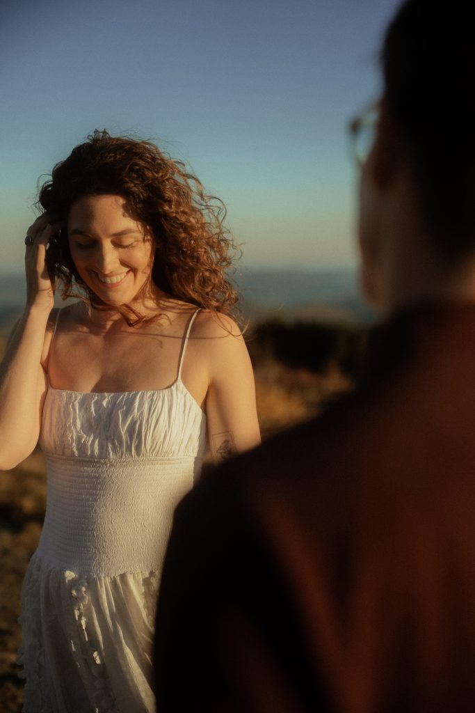
This is actually where my husband and I took our seven-year anniversary photos during a beautiful late fall sunset. Our friends, Yara and Christian from FindYara Photography, planned the perfect hike up to the bald. I felt it was ideal because the crowds had dissipated, and it was still stunning even though most of the leaves had already changed/fallen.
Best time to visit:
Sunrise or sunset for incredible lighting across the mountain balds.
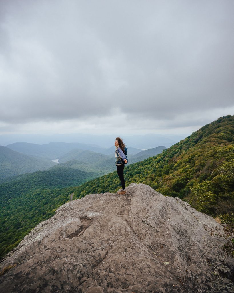
Devil’s Courthouse Trail
Distance: 0.8 miles round trip
Difficulty: Moderate to Strenuous
Location: Milepost 422.4
Parking Details: Overlook parking lot that I’ve never seen completely full
The Devil’s Courthouse Trail is one of the shortest but steepest hikes on the Blue Ridge Parkway, leading to one of the best panoramic viewpoints in the region.
The hike is less than a mile round trip, but don’t let the distance fool you; the trail climbs steadily uphill the entire way. It’s a quick workout that will definitely make you a little out of breath, but the reward at the top makes the effort completely worth it.
At the summit, you’ll find incredible views of the surrounding Blue Ridge Mountains, making it one of the best scenic overlooks along the Parkway. On clear days, you can see for miles in multiple directions.
I’ve hiked this trail several times, and it never fails to impress. The photo opportunities here are fabulous and make the pit stop worth it.
Because the trail is so steep, this hike may not be ideal for anyone needing an easy or accessible trail, but if you’re up for a quick climb, it’s absolutely worth adding to your list.
If you’re exploring more of the region, there are also numerous hikes near Cashiers that are worth adding to your itinerary.
Best time to visit:
Sunset for dramatic mountain views and incredible lighting.
Waterrock Knob Trail
Distance: 1.2 miles round trip
Difficulty: Moderate
Location: Milepost 451.2
Parking Details: Massive parking lot that I’ve only ever seen full once
The Waterrock Knob Trail is possibly my favorite hike on the Blue Ridge Parkway, which is saying a lot since I’ve done so many.
One of the things that makes this spot so special is the location. From the summit, you can look in one direction and see the Great Smoky Mountains, while the opposite direction opens up to sweeping views of the Blue Ridge Mountains.
This is also one of the best places on the Blue Ridge Parkway to watch sunrise or sunset. The overlook near the parking lot already offers fantastic views, making it accessible even to visitors who aren’t able to hike the trail.
If you do take the trail to the top, though, the views only get better. The hike is relatively short but quite steep, so it’s a quick workout that will definitely get your heart rate up. Once you reach the summit, you’ll be rewarded with incredible panoramic views in multiple directions.
Because Waterrock Knob sits at such a high elevation, the weather here can be a little unpredictable. Clouds and fog can roll in quickly, completely blocking the view, so it’s worth checking the forecast before heading out.
Every time I visit here, the view seems even more extraordinary. I’ve done this one in every single season, and it’s one of the hikes on this list that I’ll keep coming back to.
If you’re continuing west toward the Smokies, you can also explore things to do in Bryson City, another great base for outdoor adventures.
Best time to visit:
Sunrise or sunset on a clear day for the best mountain views.
Tips for Hiking on the Blue Ridge Parkway

After hiking here for years, a few things can make your trip much easier:
Start early for popular hikes
Trails like Rough Ridge and Black Balsam Knob fill up quickly, especially during the fall foliage season.
Check the weather at higher elevations
Conditions can change quickly along the Parkway, and areas like Waterrock Knob are often much colder than nearby towns.
Pack layers
Even in summer, temperatures can drop significantly at higher elevations.
Bring plenty of water
Most trails along the Parkway don’t have reliable water sources.
Check the Parkway Status
The Blue Ridge Parkway is typically open only from early April to late October at many desirable locations. Always check the status of the section you’re going to, especially during the shoulder seasons, before heading out.
FAQ: Hiking on the Blue Ridge Parkway
What are the best hikes on the Blue Ridge Parkway?
Some of the best hikes on the Blue Ridge Parkway include Rough Ridge, Black Balsam Knob, Craggy Pinnacle, Waterrock Knob, and Devil’s Courthouse. These trails offer incredible mountain views while still being relatively short and accessible from the Parkway.
Are there easy hikes on the Blue Ridge Parkway?
Yes, there are several easy hikes on the Blue Ridge Parkway that still offer beautiful scenery. Some of the best easy options include Beacon Heights, Price Lake Loop, and parts of the Linville Falls Trail.
What are the best Blue Ridge Parkway hikes near Asheville?
If you’re staying in Asheville, some of the best nearby hikes include Craggy Pinnacle, Lane Pinnacle, Frying Pan Mountain Lookout Tower, Black Balsam Knob, Graveyard Fields, and Devil’s Courthouse.
What are the best Blue Ridge Parkway hikes near Boone?
The Boone and Linville area has several incredible hikes along the Parkway, including Rough Ridge, Beacon Heights, Price Lake Loop, and Linville Falls. You can also explore many waterfalls in this area!
When is the best time to hike on the Blue Ridge Parkway?
The best time to hike the Blue Ridge Parkway is typically from late spring through fall. June is especially beautiful when rhododendrons bloom near Craggy Gardens, while October is peak fall foliage season throughout much of the Parkway.
Most of the parkway is closed in the winter.
Wrap-Up: Hiking on the Blue Ridge Parkway
Hiking on the Blue Ridge Parkway is one of the best ways to experience the beauty of the North Carolina mountains.
From iconic viewpoints like Rough Ridge and Waterrock Knob to scenic areas like Black Balsam Knob and Craggy Pinnacle, these hikes showcase some of the best that North Carolina has to offer.
If you’re planning a trip through the mountains, adding a few of these Blue Ridge Parkway hiking trails to your itinerary is an easy way to experience the best of the region.
Read More:
Best Hiking Trails North Carolina
